
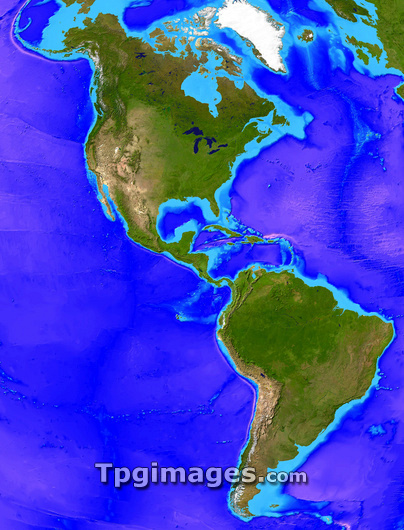
North and South America. Computer artwork, based on a satellite image, of North and South America. North is at top. Water is blue, vegetation is green, desert is yellow and ice is white. At right is the Atlantic Ocean, which extends towards the Arctic (top centre). At left is the Pacific Ocean. The islands of the Caribbean are at centre right. In North America at the USA-Canada border are the Great Lakes (upper centre). These are, clockwise from top left, Lake Superior, Lake Huron, Lake Ontario, Lake Erie and Lake Michigan. Part of northern Europe is seen at top right. The topography of the ocean floor is shown by varying shades of blue.
| px | px | dpi | = | cm | x | cm | = | MB |
Details
Creative#:
TOP03206409
Source:
達志影像
Authorization Type:
RM
Release Information:
須由TPG 完整授權
Model Release:
N/A
Property Release:
N/A
Right to Privacy:
No
Same folder images:
 Loading