
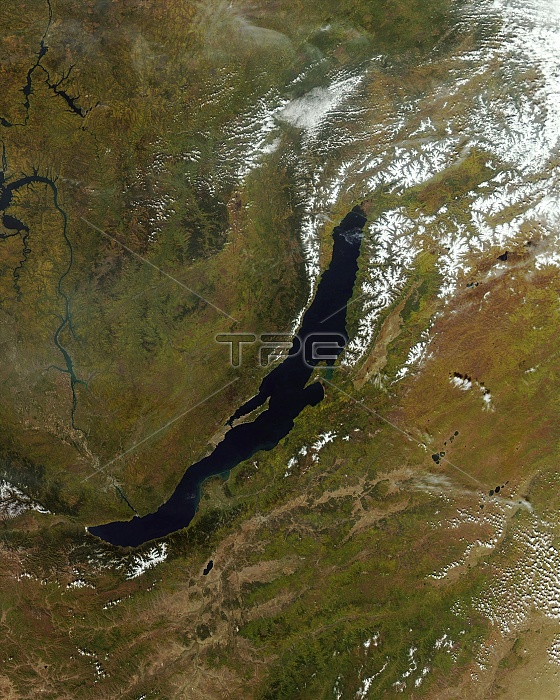
Lake Baikal, satellite image. North is at top. Water is blue, vegetation is dark green, drier areas are brown, clouds and snow and ice are white. This lake is located in the Republic of Buryatia, southern Siberia, Russia. It is 636 kilometres long and 79 kilometres wide. At a depth of 1642 metres, it is the deepest lake in the world. The Baikal Mountains are at upper right. Bratskove Reservoir (Dragon Lake) is on the edge of the image at upper left, with the Angara River flowing there from Lake Baikal. Image data obtained on 19 September 2011 by the Moderate Resolution Imaging Spectroradiometer (MODIS) instrument on NASA's Aqua satellite.
| px | px | dpi | = | cm | x | cm | = | MB |
Details
Creative#:
TOP11247511
Source:
達志影像
Authorization Type:
RM
Release Information:
須由TPG 完整授權
Model Release:
No
Property Release:
No
Right to Privacy:
No
Same folder images:
 Loading