
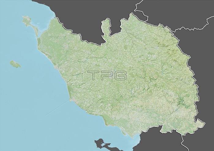
Relief map of the departement of Vendee, France. Bordered by the Atlantic ocean to the west, it includes Ile d'Yeu and Noirmoutier islands. This image was compiled from data acquired by LANDSAT 5 & 7 satellites combined with elevation data.
| px | px | dpi | = | cm | x | cm | = | MB |
Details
Creative#:
TOP13896819
Source:
達志影像
Authorization Type:
RM
Release Information:
須由TPG 完整授權
Model Release:
No
Property Release:
No
Right to Privacy:
No
Same folder images:
 Loading