
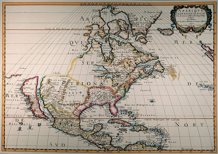
MAP OF NORTH AMERICA, 1650. /nBy Nicolas Sanson; the first printed map to show all five of the Great Lakes and vaguely locating the legendary lands of Cibola and Quivira in the southwest.
| px | px | dpi | = | cm | x | cm | = | MB |
Details
Creative#:
TOP16099925
Source:
達志影像
Authorization Type:
RM
Release Information:
須由TPG 完整授權
Model Release:
No
Property Release:
No
Right to Privacy:
No
Same folder images:
 Loading