
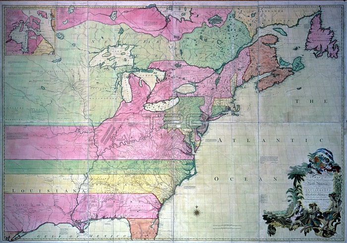
NORTH AMERICAN MAP, 1755. /nA map of the British and French Dominions in North America, by John Mitchell of Virginia, engraved in London, 1755. Colored bands represent claims to western lands made by individual colonies.
| px | px | dpi | = | cm | x | cm | = | MB |
Details
Creative#:
TOP16114645
Source:
達志影像
Authorization Type:
RM
Release Information:
須由TPG 完整授權
Model Release:
No
Property Release:
No
Right to Privacy:
No
Same folder images:
 Loading