
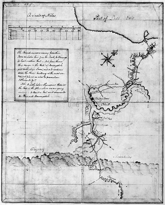
WASHINGTON: SURVEY, c1754. /nMap drawn by George Washington showing the territory he traversed in 1753-54 between Cumberland, Maryland, and Fort Le Boeuf, near Waterford, Pennsylvania, including his assessment of the strength of French troops in the region.
| px | px | dpi | = | cm | x | cm | = | MB |
Details
Creative#:
TOP16138436
Source:
達志影像
Authorization Type:
RM
Release Information:
須由TPG 完整授權
Model Release:
No
Property Release:
No
Right to Privacy:
No
Same folder images:
 Loading