
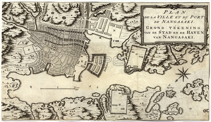
Dutch map of Nagasaki. 18th-century map of Nagasaki, Japan, with a bilingual (French and Dutch) title. The French title is: Plan de la ville et du port de Nangasaki. The Dutch title is: Grond tekening van de stad en de haven van Nangaski. Both translate as 'Map of the city and the port of Nagasaki'. The map shows the Emperor's Palace, the Governor's houses, temples, the house of the Port inspector and the Chinese quarter. Nagasaki was the main entry point for Westerners into Japan at this time. The area at centre is the Dejima, a Portuguese island-prison. From 1720, a ban on Dutch books was lifted and scholars came here to study European science and art.
| px | px | dpi | = | cm | x | cm | = | MB |
Details
Creative#:
TOP16235318
Source:
達志影像
Authorization Type:
RM
Release Information:
須由TPG 完整授權
Model Release:
N/A
Property Release:
N/A
Right to Privacy:
No
Same folder images:
 Loading