
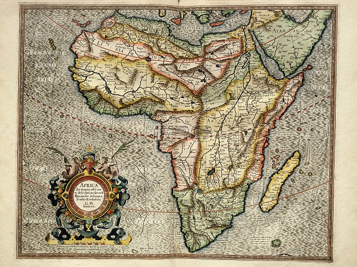
Africa, 1595 Mercator atlas. 16th-century Dutch map of Africa with inscriptions and labels in Latin. Historic regions shown here include the Barbary Coast, Biledulgerid, Libya Interior, Agisymba, Nubia, Abyssinia, Biafra, Manicongo. These names were used by Ptolemy to describe Africa in the 2nd century, with much of the interior still unknown in the 16th century. The inscription at lower left says the map is by Gerard Mercator Junior, based on maps by his grandfather, Flemish cartographer Gerardus Mercator (1512-1594). This copy of the map is from 'Atlas Sive Cosmographicae Meditationes de Fabrica Mundi et Fabricati Figura' (Duisburg, 1595).
| px | px | dpi | = | cm | x | cm | = | MB |
Details
Creative#:
TOP16235323
Source:
達志影像
Authorization Type:
RM
Release Information:
須由TPG 完整授權
Model Release:
N/A
Property Release:
N/A
Right to Privacy:
No
Same folder images:
 Loading