
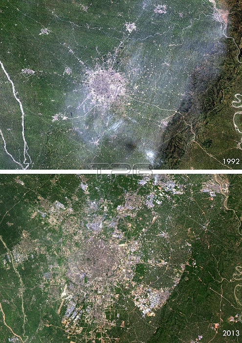
Chengdu urban spread. Satellite images of Chengdu, China in 1992 (top) and 2013 (bottom), showing how the urban area (grey) has expanded over the years to cover more of the surrounding countryside (green).
| px | px | dpi | = | cm | x | cm | = | MB |
Details
Creative#:
TOP16630930
Source:
達志影像
Authorization Type:
RM
Release Information:
須由TPG 完整授權
Model Release:
N/A
Property Release:
N/A
Right to Privacy:
No
Same folder images:
2000201320thcentury21stcenturyasiaasiancartographychangechengduchinachinesecitycomparedcomparingcomparisoncountriescountrydeforestationearthobservationenvironmentenvironmentalscienceexpandingexpansionfromabovefromspacegeographicalgeographyimpactlandlandusemapno-onenobodysatelliteimagespreadspreadingurbanurbanspreadurbanisation
2000201320th21staboveasiaasiancartographycenturycenturychangechengduchinachinesecitycomparedcomparingcomparisoncountriescountrydeforestationearthenvironmentenvironmentalexpandingexpansionfromfromgeographicalgeographyimageimpactlandlandmapno-onenobodyobservationsatellitesciencespacespreadspreadspreadingurbanurbanurbanisationuse
 Loading