
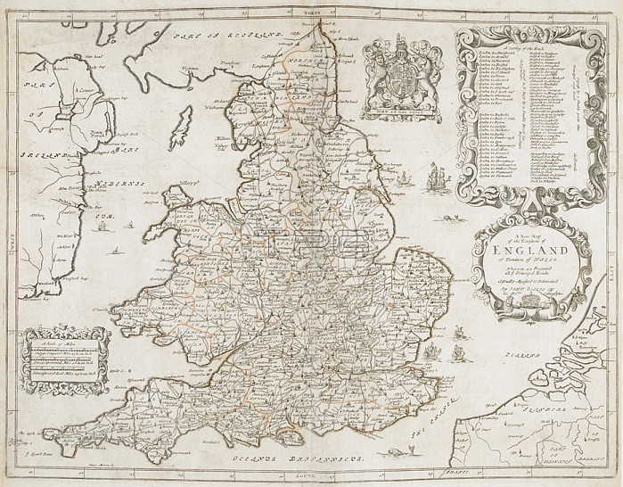
James Moxon.A map of England and Wales; Also showing the west coast of Ireland. 500 x 380 mm. fol.1675.From: James Moxon; A New Map of the Kingdom of England & Dominion of Wales. actually measured & delineated by John Ogilby; Esqr. James Moxon S.Maps. C. 6. d. 8London; British Library.
| px | px | dpi | = | cm | x | cm | = | MB |
Details
Creative#:
TOP20493204
Source:
達志影像
Authorization Type:
RM
Release Information:
須由TPG 完整授權
Model Release:
No
Property Release:
No
Right to Privacy:
No
Same folder images:
Restriction:
Additional permissions needed for non-editorial use.
 Loading