
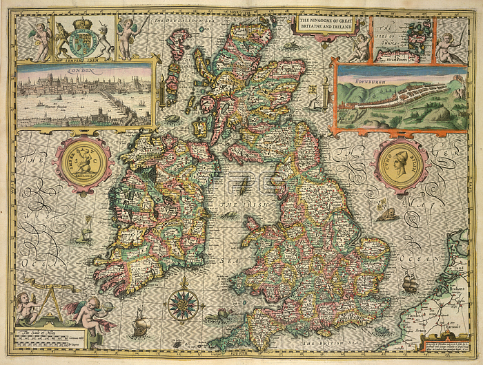
A map of Great Britain and Ireland.London: John Sudbury & George Humble; 1611.From: The Kingdome of England. Described by Christopher Saxton; augmented by John Speed. Jodocus Hondius Flander caelavit. 1610. (A Catalogue of all the Shires; Cities; Bishoprickes; Market-Townes; Castles; Parishes; Rivers; Bridges; Chases; Forrests and Parkes. of England.) The scale of miles; 50[ = 58 mm.]. [Surrounded by male and female figures wearing the costumes appropriate to the different classes of society].Maps C. 7. c. 20. (2.)London; British Library.
| px | px | dpi | = | cm | x | cm | = | MB |
Details
Creative#:
TOP20497930
Source:
達志影像
Authorization Type:
RM
Release Information:
須由TPG 完整授權
Model Release:
No
Property Release:
No
Right to Privacy:
No
Same folder images:
Restriction:
Additional permissions needed for non-editorial use.
 Loading