
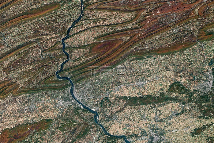
Natural-color image, taken by the Landsat satellite, reveals the Susquehanna River system. In this image, the river cuts right through several ridge lines, without regard to rock or gravity. In every place where the river flows through the mountains, it is pouring through a gap that must have existed before. Located north of Harrisburg, Pennsylvania, below the lower edge of the image, the region is called the Susquehanna Water Gap. The trees along the ridge lines are gold, orange, and red, hinting that the coolness of autumn had settled over the region on October 21, 2001. At lower elevations, the trees remained dark green. The fertile valleys are filled with squares of pink, tan, and green agricultural fields. Many crops had been harvested, leaving behind golden stubble or red-brown bare earth. Bright white roads line both the Susquehanna and Juniata Rivers. Small cities, Marysville near the bottom edge of the image and Duncannon near the confluence of the two rivers, are concentrated dots of white-gray.
| px | px | dpi | = | cm | x | cm | = | MB |
Details
Creative#:
TOP22085296
Source:
達志影像
Authorization Type:
RM
Release Information:
須由TPG 完整授權
Model Release:
N/A
Property Release:
No
Right to Privacy:
No
Same folder images:
 Loading