
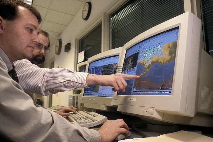
Weather forecasting. Meteorologists tracking storms by computer. The Advanced Weather Interactive Processing System (AWIPS) combines data from Doppler radar, weather satellites, observation systems and forecasting models into a geographic weather display on a computer screen. The resulting maps can be used to track weather systems and aid local forecasting. These meteorologists are using the AWIPS to track storms in the notorious Tornado Alley in the American mid-west, an area that includes the states of Kansas, Nebraska, Oklahoma and northern Texas, where tornadoes are frequent. Photographed at the National Weather Service in Wichita, Kansas, USA.
| px | px | dpi | = | cm | x | cm | = | MB |
Details
Creative#:
TOP22286053
Source:
達志影像
Authorization Type:
RM
Release Information:
須由TPG 完整授權
Model Release:
No
Property Release:
No
Right to Privacy:
No
Same folder images:
 Loading