
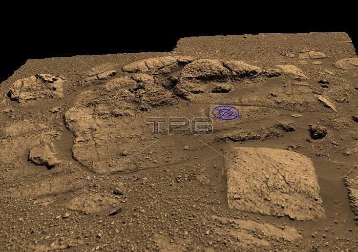
This graphic is a planning tool used by Mars Exploration Rover engineers to plot and scheme the perfect location to place the rock abrasion tool on the rock collection dubbed "El Capitan" near Opportunity's landing site. "El Capitan" is located within a larger outcrop nicknamed "Opportunity Ledge." The rover visualization team from NASA Ames Research Center, initiated the graphics by putting two panoramic camera images of the "El Capitan" area into their three-dimensional model. The rock abrasion tool team from Honeybee Robotics then used the visualization tool to help target and orient their instrument on the safest and most scientifically interesting locations. The blue circle represents one of two current targets of interest, chosen because of its size, lack of dust, and most of all its distinct and intriguing geologic features.
| px | px | dpi | = | cm | x | cm | = | MB |
Details
Creative#:
TOP22312657
Source:
達志影像
Authorization Type:
RM
Release Information:
須由TPG 完整授權
Model Release:
N/A
Property Release:
No
Right to Privacy:
No
Same folder images:
 Loading