
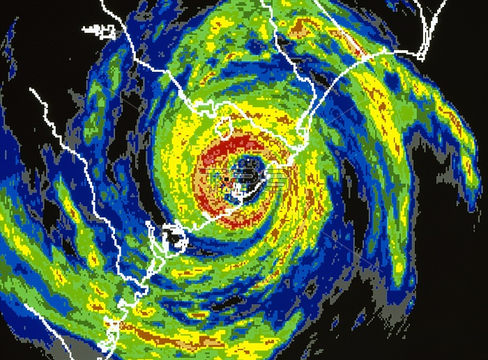
Colored satellite radar image of Hurricane Hugo as it approached the coastline of South Carolina on September 22, 1989. The image shows cloud cover from gray (lightest) to red (heaviest). The hurricane consists of thick clouds which swirl around a central clear, calm "eye". Hugo began as a cluster of storms detected off the coast of Africa on September 9th. With maximum sustained wind speeds of 260 kilometers per hour, Hugo left a trail of destruction across the Leeward Islands, the Virgin Islands, Puerto Rico and South and North Carolina. Damage was estimated at four billion dollars and over 50 lives were lost.
| px | px | dpi | = | cm | x | cm | = | MB |
Details
Creative#:
TOP22314374
Source:
達志影像
Authorization Type:
RM
Release Information:
須由TPG 完整授權
Model Release:
No
Property Release:
No
Right to Privacy:
No
Same folder images:
 Loading