
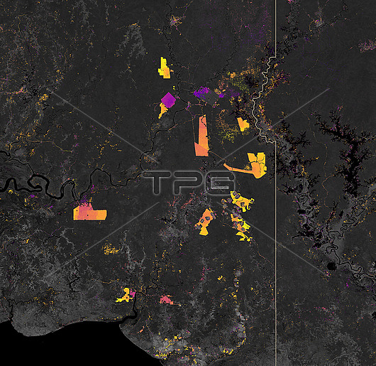
Map showing deforestation in Papua, Indonesia using data from 2002 to 2019. Lighter coloured hotspots show more recent forest loss in comparison to purple-pink hotspots. Southern Papua has seen the deforestation of its forests for plantations. This map created using data obtained by forest change data from the University of Maryland and NASA Landsat satellite data.
| px | px | dpi | = | cm | x | cm | = | MB |
Details
Creative#:
TOP26437022
Source:
達志影像
Authorization Type:
RM
Release Information:
須由TPG 完整授權
Model Release:
N/A
Property Release:
N/A
Right to Privacy:
No
Same folder images:
 Loading