
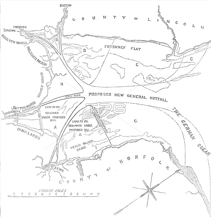
Plan of the Wash, between the Coasts of Norfolk and Lincolnshire, 1850. Creator: Unknown.
| px | px | dpi | = | cm | x | cm | = | MB |
Details
Creative#:
TOP27868169
Source:
達志影像
Authorization Type:
RM
Release Information:
須由TPG 完整授權
Model Release:
No
Property Release:
No
Right to Privacy:
No
Same folder images:
riverseacoastUKEnglandcoastalengineeringBritishlandgeographymouthmarshNorfolkLincolnshireboglocationVictoriancenturyBritainnewspaperspressswampNorthSeacivilengineeringB&Wmarshesengravedengravingestuarymarshland19thcenturyblack&whiteblackandwhiteB/WnineteenthcenturyRiverOuseThePrintCollectorgeographicalfeatureIllustratedLondonNewsTGNILNnewspapermaplandreclamationUnknown19th-centuryOuse
&19th19th-centuryB&WB/WBritainBritishCollectorEnglandILNIllustratedLincolnshireLondonNewsNorfolkNorthOuseOusePrintRiverSeaTGNTheUKUnknownVictorianandblackblackbogcenturycenturycenturycivilcoastcoastalengineeringengineeringengravedengravingestuaryfeaturegeographicalgeographylandlandlocationmapmarshmarshesmarshlandmouthnewspapernewspapersnineteenthpressreclamationriverseaswampwhitewhite
 Loading