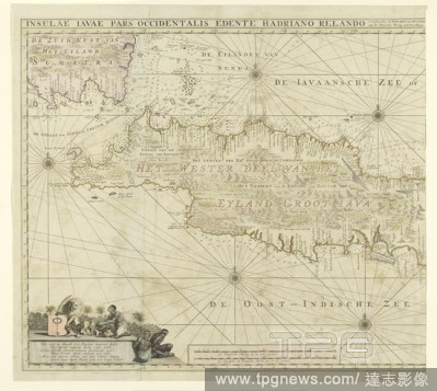
EditorialMap of the western part of Java, Insulae Iavae Pars Occidentalis Edente Hadriano Relando (title on object), Map of West Java and a tip of Sumatra (inks above). There are five compass roses. There are topographical details on the map: rice fields, mount...
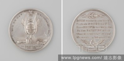
EditorialLanding of the British and Russians at Callantsoog and Battle of Castricum, Silver Medal. Obverse: weapon trophy, crowned by freedom hat with oak wreath, illuminated by all-seeing eye, mask, smoking torch, dagger, buoys, piece of paper, gunpowder and g...
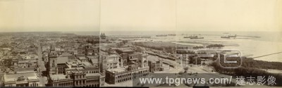
EditorialPanorama, Madras Harbour, 1900-01. A panoramic view consisting of three joined prints, mounted on linen. The view is taken from the lighthouses looking north, with the centre of the city on the left, and the enclosed harbour with steamers at anchor on ...
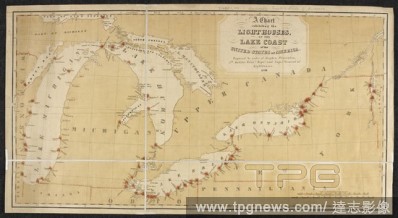
EditorialA chart showing the lighthouses on the coasts of the Great Lakes of America. A Chart exhibiting the Light Houses, on the Lake Coasts of the United States of America ... Scale of statute miles, 150[ = 150 mm]. [Washington], 1848. Source: Maps 71495.(133...
EditorialA charts illustrated with sketches of lighthouses along the coasts of Norway and Sweden. . Lighthouse recognition chart, Series GSGS 4481. [London] : War Office, 1944. Second edition. Source: Maps MOD GSGS 4481 Sheet 2, Norway south.
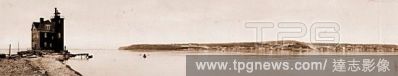
EditorialMackinac Island from Round Island, Michigan, Jackson, William Henry, 1843-1942, Islands, Lighthouses, United States, Michigan, Mackinac Island (Island), United States, Michigan, Round Island, United States, Michigan, Mackinac Island, 1899.
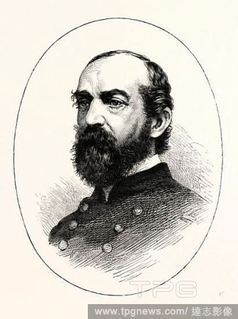
EditorialGENERAL MEADE, He was a career United States Army officer and civil engineer involved in coastal construction, including several lighthouses. He fought with distinction in the Second Seminole War and Mexican-American War. During the American Civil War ...


 Loading